- Find Answers
- :
- Using Splunk
- :
- Dashboards & Visualizations
- :
- Overlaying indoorplan on the choropleth map
- Subscribe to RSS Feed
- Mark Topic as New
- Mark Topic as Read
- Float this Topic for Current User
- Bookmark Topic
- Subscribe to Topic
- Mute Topic
- Printer Friendly Page
- Mark as New
- Bookmark Message
- Subscribe to Message
- Mute Message
- Subscribe to RSS Feed
- Permalink
- Report Inappropriate Content
Hi everyone,
I want to overlay a picture (indoor plan) on the map so I can display the results on this indoor map, is there anyway to do it ??
Thanks for answering
- Mark as New
- Bookmark Message
- Subscribe to Message
- Mute Message
- Subscribe to RSS Feed
- Permalink
- Report Inappropriate Content
There'a great write up in Splunk Blogs for Custom Geospatial Lookups.
The hardest part is a step not mentioned: Creating the KML or Shapefile for your custom map. Some possible tips/pointers for that can be found elsewhere on the net, search for "create shapefile" to get started.
If you can get that done, the rest of the process seems relatively straightforward.
- Mark as New
- Bookmark Message
- Subscribe to Message
- Mute Message
- Subscribe to RSS Feed
- Permalink
- Report Inappropriate Content
As a possible alternative solution, if you have Splunk Enterprise Security or ITSI you have Glass Tables.
It won't quite do a chloropleth, but it's still possibly useful as a proof of concept or, in dire cases, the actual map. In that case, just use your image as the background ad drop single-value visualizations all over it. I've done it with floor plans before - it seems to work fine.
- Mark as New
- Bookmark Message
- Subscribe to Message
- Mute Message
- Subscribe to RSS Feed
- Permalink
- Report Inappropriate Content
There'a great write up in Splunk Blogs for Custom Geospatial Lookups.
The hardest part is a step not mentioned: Creating the KML or Shapefile for your custom map. Some possible tips/pointers for that can be found elsewhere on the net, search for "create shapefile" to get started.
If you can get that done, the rest of the process seems relatively straightforward.
- Mark as New
- Bookmark Message
- Subscribe to Message
- Mute Message
- Subscribe to RSS Feed
- Permalink
- Report Inappropriate Content
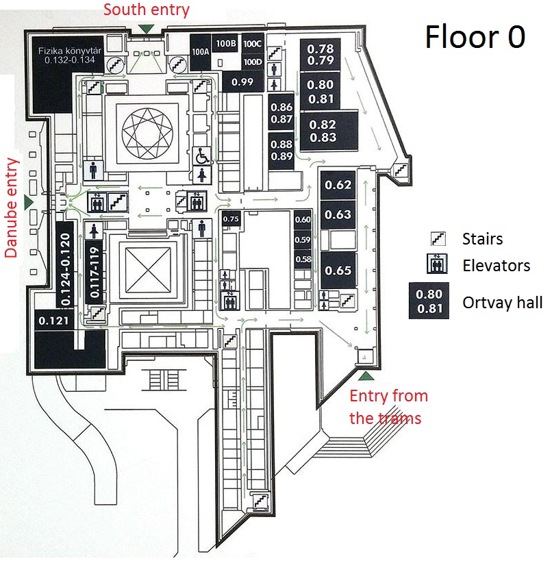
Thanks for your answer it was deeply informatif for me, otherwise what i want to check with you if it s possible to overlay this picture (joined) on the map. since this type of data is not available on google maps.
thanks for your help
- Mark as New
- Bookmark Message
- Subscribe to Message
- Mute Message
- Subscribe to RSS Feed
- Permalink
- Report Inappropriate Content
So I believe you have an image you'd like to use as the basis for your map.
I am no expert. Indeed, I know what I know mostly from Google (with a dose of 20 years of experience in IT) but I found a few hints.
Try using QGIS. There's some information here on QGIS's Tutorials on creating a "map". That uses a vector based format but it appears there's a similar menu item for raster based graphics. So you'd (I guess) import that, then follow along that tutorial and give it a try. I'd start simple, just try to get two places showing up properly (for all that it matters, something simple like "left half" vs. "right half" should be fine). Once you get that working, it should be easy to make it better.
This answer is a bit outside of Splunk itself. That's OK, and I think if we find and write up a decent solution there are a lot of folks using Splunk that will appreciate this. We're not weirdos about that.
I may try my hand this week at something like what you want, because I have some use cases that would lend themselves really well to this. If I do, I'll try to write more here or maybe get a blog entry up.
